Shopping cart,
0 products
There are no products in your shopping cart.
Nội dung bài viết
The Ha Giang to Cao Bang route is one of the most scenic and rewarding road journeys in northern Vietnam. Connecting two legendary mountain regions, this route takes travelers through dramatic limestone landscapes, winding mountain passes, remote ethnic villages, and some of the most beautiful natural wonders in the country.
Unlike fast highways, this journey is meant to be slow. Every curve reveals a new view, and every stop offers a deeper connection to Vietnam’s northern highlands.
The route links Ha Giang Province with Cao Bang Province, stretching approximately 300–350 km, depending on the chosen roads. It is commonly traveled after completing the Ha Giang Loop, making it a natural extension for travelers who want to continue deeper Vietnam’s wild north.
Most travelers start from:
Dong Van or Meo Vac (Ha Giang)
and finish in:
Cao Bang City or Ban Gioc Waterfall
What makes the Ha Giang to Cao Bang exceptional is its diversity:
Towering karst mountains and deep valleys
Remote ethnic villages of the H’Mong, Tay, and Nung people
Quiet roads with little traffic
Authentic rural life untouched by mass tourism
This route feels less crowded than the Ha Giang Loop, offering a more peaceful and immersive travel experience.
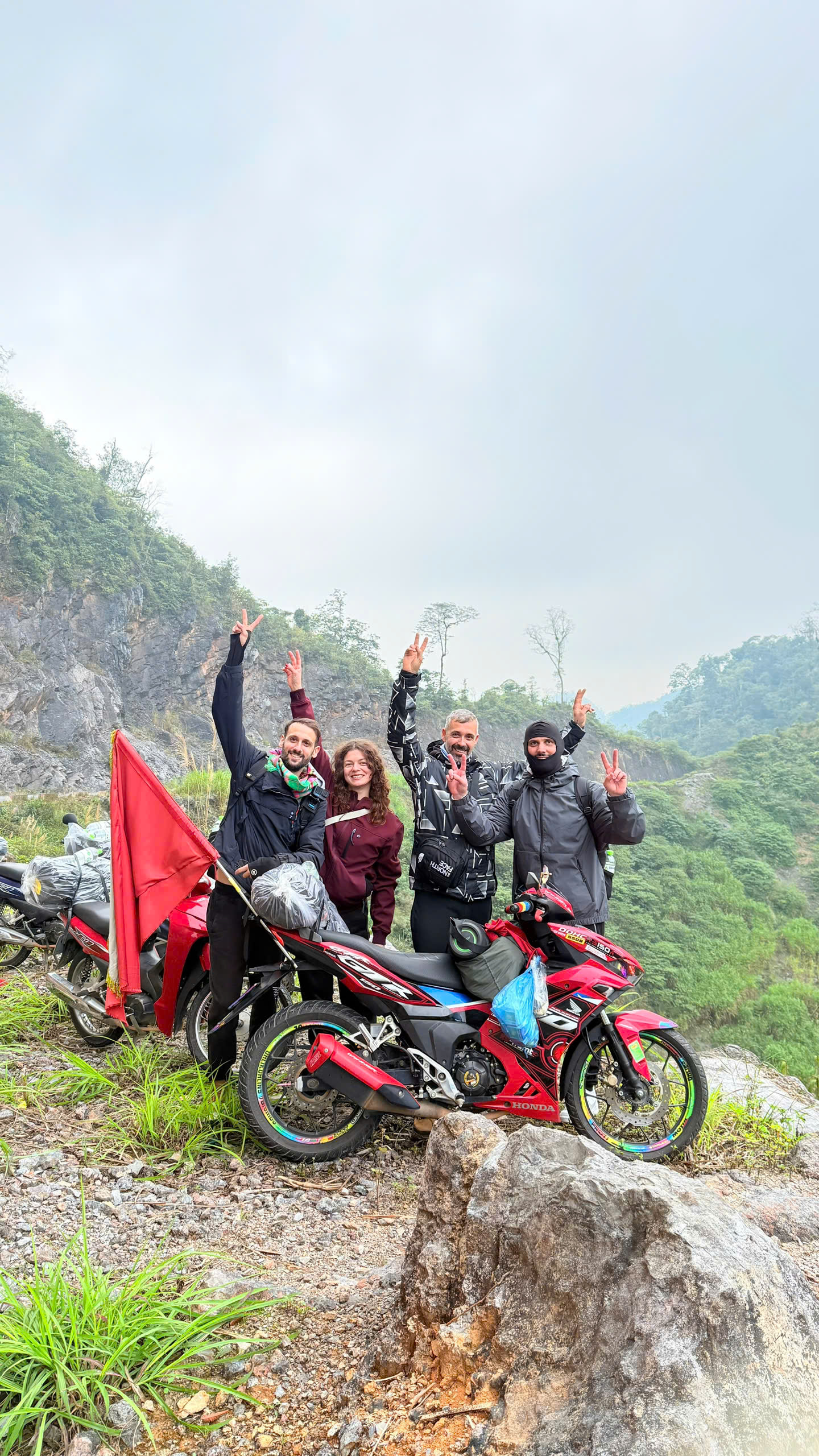
• Ma Pi Leng Pass (Ha Giang)
One of Vietnam’s most famous mountain passes, offering breathtaking views of the Nho Que River far below.
• Remote Border Roads
As you approach Cao Bang, the scenery softens rolling hills, rivers, and farmland, creating a gentle contrast to Ha Giang’s rugged cliffs.
• Ma Phuc Pass (Cao Bang)
A graceful mountain pass with winding curves and wide-open views, marking your arrival Cao Bang’s limestone heartland.
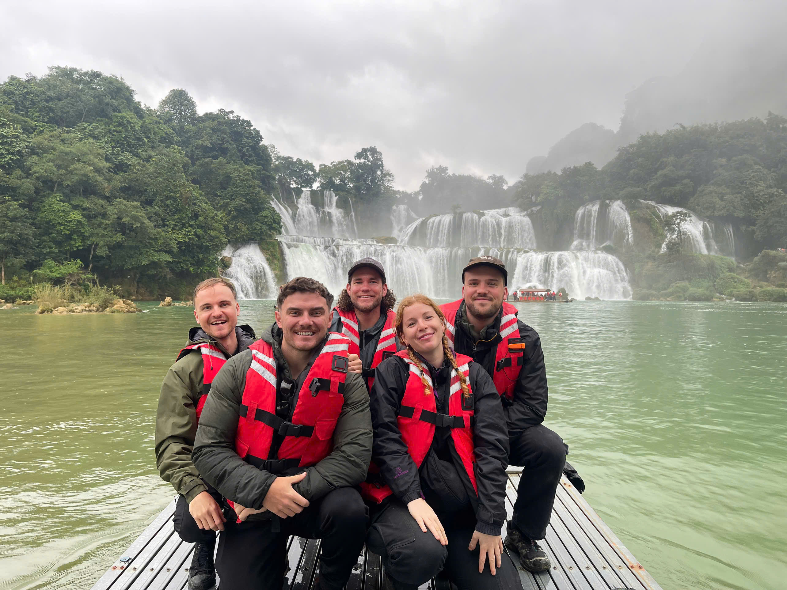
• Ban Gioc Waterfall
Often the final highlight of the journey, Ban Gioc Waterfall is Vietnam’s most spectacular waterfall, located near the border with China.
Although the distance is moderate, the mountain roads make travel slower. Most travelers complete the Ha Giang to Cao Bang in:
2–3 days for relaxed travel
3–4 days if combining sightseeing and photography
Daily distances usually range 80–120 km, allowing time to stop, explore, and enjoy the views.
There are several ways to experience the Ha Giang to Cao Bang route:
Motorbike – Ideal for experienced riders seeking adventure
Private car or SUV – Comfortable and safe for longer distances
Jeep tour – Perfect for panoramic views and stress-free travel
For travelers who want comfort, safety, and local insight, guided trips with Jasmine Tours offer well-planned itineraries, experienced drivers, and flexible schedules.
The best seasons for this route are:
September – November: Clear skies, golden rice fields, strong waterfalls
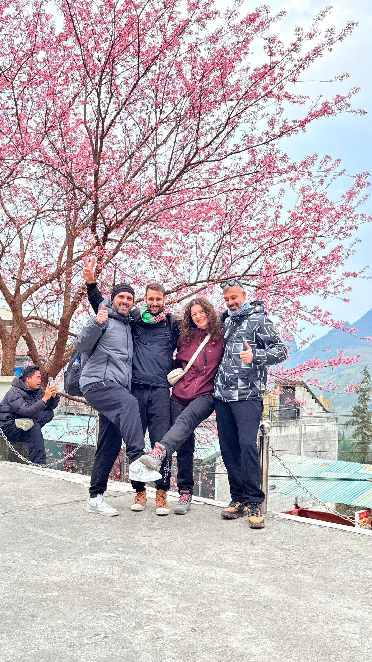
March – May: Mild weather, fresh greenery, flowering valleys
Winter offers misty, atmospheric views, while summer brings lush landscapes but occasional rain.
Together, Ha Giang and Cao Bang represent two different personalities of northern Vietnam:
Ha Giang: Dramatic, bold, adventurous
Cao Bang: Gentle, poetic, deeply peaceful
The Ha Giang to Cao Bang connects these worlds, creating a journey that feels complete, balanced, and unforgettable.
Conclusion
The Ha Giang to Cao Bang route is more than a road—it is a story written in mountains, rivers, and villages. It rewards those who travel slowly, listen carefully, and allow the landscape to guide them.
For travelers seeking authenticity, natural beauty, and a deeper connection with northern Vietnam, this route is one of the finest journeys the country has to offer.
There is 0 comment, review about Ha Giang to Cao Bang Route – The Ultimate Northern Vietnam Journey
TVQuản trị viênQuản trị viên
Xin chào quý khách. Quý khách hãy để lại bình luận, chúng tôi sẽ phản hồi sớm